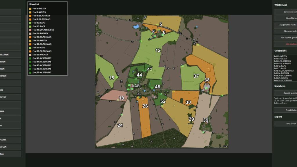
The KTD Agrar crop planner is a simple Windows tool for visually planning crop areas. Based on a loaded screenshot or map image, field areas can be drawn, numbered and colored with crops.
The tool offers a clear list of areas, automatically sorts the fields by number and shows the current occupancy directly in the plan. Projects can be saved and reloaded later. The finished cultivation plan can be exported as a PNG, including an area overview in the image.
Credits:
KTDAGRAR
Download mod
| File | File size |
|---|---|
 KTD_Anbauplaner
|
176 KB |